 If we were looking for another one of those great riding areas the West is known for, we might not necessarily choose a place named the Flattops. With a name like that, you'd more than likely think in terms of somewhere in the flatlands of the Midwest.
The Flattops doesn't necessarily conjure up images of a place that would attract mountain riders looking for a challenge-especially in the state of Colorado, which is known for having some pretty darn impressive peaks. Colorado has the distinction of having more Fourteeners than any other state in America. Fourteeners are mountains that are 14,000 feet or higher and Colorado has 58 of them.
Colorado is also home to the Flattops.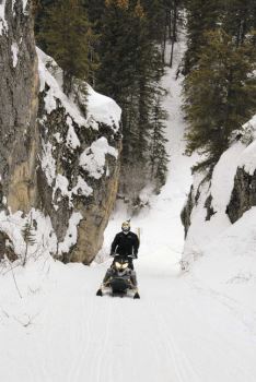
The Flattops are surrounded by some of Colorado's most famous and thus popular snowmobiling areas. There's the Grand Mesa to the west and Rabbit Ears to the northeast. A bit farther east is Grand Lake.
Throw all that together and you might think the Flattops are just a place you should pass by as you cruise along Interstate 70 to get to some real western riding in the state.
Think again. The Flattops easily hold their own against the heavyweights of the snowmobiling world. In fact, it's the very uniqueness of the Flattops that makes it such a great place to explore from the seat of a snowmobile. And, contrary to what the name might suggest, there are plenty of places to hillclimb, bust powder and boondock.
From A Distance
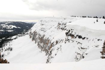 From a distance, the name might seem to fit the area known as Flattops-it actually looks kind of like a tabletop where the edges fall off to the valleys below. There aren't any towering mountains that punctuate the landscape nor does it look like the terrain changes much once you get on top of the Flattops. It's only when you get closer that you realize the terrain is diverse and challenging and not what you expected.
From all appearances, our two days of riding the Flattops revealed the area has a loyal following of sledders who go there to enjoy the dramatic drainages and cliffs that define (and separate) the riding here.
Even with two days of riding, we, as usual, got a pretty good feel for the area and hit the highlights, but left acre after acre untouched and undiscovered, perhaps to be explored another day. It's what we experienced those two days that left us with a desire to see more.
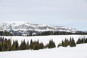 Generally speaking, think of the Flattops not shaped as a table but more like a circle worn away at the edges by streams and creeks that drain the mountains of their plentiful snowfall. A fair chunk of that circle (235,214 acres) is home to the Flat Tops Wilderness (the National Forest Service treats the Flat Tops Wilderness as two words), which is, of course, off limits to motorized recreation. Interstate 70 is the southern border of the Flattop area. Most of the Flattops are in the White River National Forest with a small portion in the Routt National Forest.
We covered portions of the southwest part of the Flattops snowmobiling area during our two days of ridings, leaving from the West Elk trailhead on the first day and the Rifle Creek trailhead on day two. Those two trailheads are just two of more than a half-dozen trailheads that access nearly all sides of the Flattops. Half of the trailheads are scattered across the southern part of the Flattops. It should also be noted that of all the trailheads that serve the Flattops, five have groomed trails that leave from the parking areas, while the others have marked but not groomed trails. These are clearly distinguished on the trail map.
Trailheads
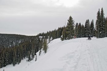 The West Elk trailhead is accessed out of the town of Silt, CO, and you gain just about 4,000 feet in elevation from town to the trailhead. The snow gets deeper and the temperatures drop too, reflective of what you'd see leaving just about anywhere along the valley floor before climbing to the Flattops. For example, Rifle, which sits at 6,140 feet, has an average high in January of about 37 degrees F with an annual snowfall of 56 or so inches. Silt is at 5,300 feet, averages 36.4 degrees F in January and has an average snowfall of 39.7 inches. Glenwood Springs, another popular access point to the snowmobile trailhead (Transfer Trail) has similar numbers. But once you get up on top, all that changes as you're riding between 7,800-11,300 feet and the snowfall is between 200-250 inches a year.
If you were keeping track on the math end of driving from Silt to the West Elk trailhead, you would have figured out that the trailhead sits at about 9,300 feet. Then when you look at the riding range we just quoted (7,800-11,300 feet) you'll realize that once you unload at that trailhead you'll be riding up and down. That's courtesy of the numerous drainages that flow down from the Flattops. Compare that to the Rifle Creek trailhead where you unload at 7,630 feet and you can see all the riding is up from there.
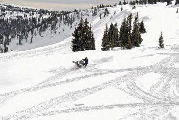 The drive up from Rifle to that trailhead is decidedly different than the trek from Silt to West Elk. Both start out similarly-driving through ranching country-but end much differently. You're on a steady climb to West Elk on the last part of the drive, while the latter part of the drive to Rifle Creek is along East Rifle Creek through an awesome narrow canyon. West Elk and Rifle Creek are the two biggest trailheads in the Flattops.
Blair Mountain is the centerpiece when it comes to the Flattops. That seems to be the reference point when talking about anything to do with this part of Colorado and for good reason-it's an amazing piece of geology. Although most of us would most likely name it Blair Cliffs, the official name is Blair Mountain and it's 11,400 feet tall at its highest point. If you're trying to picture Blair Mountain as a traditional peak, scratch that and think of it more as a ridgeline that extends for quite a ways. Cliff really does describe it better because it's not much of a climb from the west side of the mountain to where it drops off the edge-which is where the "cliff" part comes in. The Wilderness area begins at the edge of the cliff, which is also a drop of about a thousand feet. Not only would dropping off the edge of Blair Mountain here be illegal, it would be deadly as it is virtually straight down. You can, however, ride along the entire ridgeline of Blair Mountain.
South Of Blair Mountain
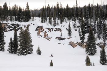 At the southern end of Blair Mountain, just past the edge of the Wilderness, is a popular hillclimbing spot near Elk Lakes, a group of four small lakes. Here is where we found some of the deepest snows during our two days of riding, thanks in part to the east-facing slope. The boondocking here was excellent too as you made your way through the trees on off-camber hills.
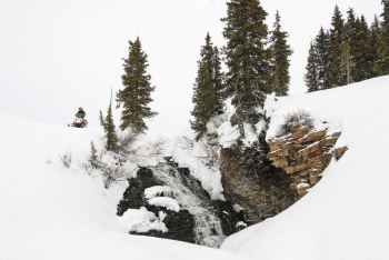
Not far away is Canyon Creek Canyon, where we found a small waterfall and some great riding. The light was somewhat flat while we were in this part of the Flattops so we didn't dare explore too much for fear of dropping off into a drainage we couldn't get back out of.
A popular stop on the way out to Blair Mountain from the western trailheads is off trail A1, between the Hiner Spring junction and turnoff to Meadow Creek Lake. Between those two junctions, the trail goes right along the edge of another pretty significant dropoff. From this overlook you get a great view of Cliff Lakes and the Flat Top Wilderness in the distance.
If sledders choose to access Blair Mountain from the Rifle Creek trailhead, they head up Little Box Canyon, where towering hillsides flank both sides of the trail. It's a great ride up the mountain before you come out into some wide open areas.
There are loop trails-groomed and ungroomed-in the Flattops as well as Point A to Point B kinds of trails. In all, there are 190 miles of groomed trails in the Flattops with hundreds more miles of ungroomed trails that lead to numerous parks (remember, that's what Coloradoans call big, wide open meadows) where you can track up the powder.
And even though the name of the area is the Flattops, the terrain is ever-changing with numerous cliffs to admire but also watch out for.
So while the name Flattops might be a bit deceiving, the snowmobiling is anything but. It's the real deal that is worth any amount of time you can spend there.
Elevation 7,800-11,300 feet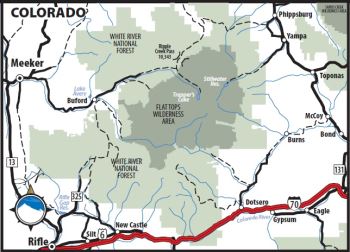
Snowfall 200-250 inches
Miles of Groomed Trails 190
Full Service Town Rifle, Silt, Meeker, Glenwood Springs
Nearest Airport Grand Junction (60 miles from Rifle); Eagle/Vail County (25 miles from Glenwood Springs)
Getting Started Rifle Chamber of Commerce (800) 842-2085 www.riflechamber.com; Silt Area Chamber of Commerce (970) 876-9922 www.siltchamber.com; Glenwood Springs Chamber Association (970) 945-6589 www.glenwoodchamber.com; Meeker Chamber of Commerce (970) 878-5510 www.meekerchamber.com
Getting There Rifle, Silt and Glenwood Springs are all located on Interstate 70. Meeker is 40 miles north of Rifle on Colorado Highway 13.
Getting Around The Glenwood Springs Chamber Association lists a couple of companies that rent snowmobiles. Contact the other chambers for more information on snowmobile rentals in their towns.
Bedding Down There are plenty of accommodations of all kinds scattered throughout the area. The biggest concentration of lodging is in Glenwood Springs, which is home to the world's largest hot springs pool and has a ski resort nearby. However, Glenwood Springs doesn't feel like one of those uppity, upscale ski resorts/towns Colorado is known for.
Eating Out Again, there are a variety of restaurants scattered all over the region to satisfy any kind of taste and appetite. Restaurant listings are available on each chamber's website listed above.